
A reader who left Guantanamo decades ago asked if I could post pictures of her city, because she wants to see what it looks like now. I’m sorry that I have none. I passed through Guantanamo once, ate lunch there, the temperature felt like 120 degrees, and I shot no pictures.
But while we’re on the subject, I have a question for readers. Why is Guantanamo the driest place in Cuba?
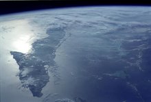
When you approach Guantanamo from the west, you leave the green landscape of Santiago and the last foothills of the Sierra Maestra. On the coastal highway, the green disappears and the landscape turns arid before you get to the city of Guantanamo, and you even see cactus on the side of the road. It remains that way well beyond the city, continuing to the east. Before you reach the eastern tip of the island, the road cuts to the north, heading into the mountains toward Baracoa – and once you make that turn to the north, within a few kilometers the landscape changes again and you are in a tropical forest.
Does anyone know what explains this microclimate? I found one article about efforts to cope with it, but have found nothing about its cause.


4 comments:
Perhaps the soil does not retain the little rainfall that does fall.
You got yourself a typical rain shadow from the mountains to the north. The water carried by the pervailing winds gets dumped to the north of the mountains, making Baracoa wet. You have the same phenomenon around Kingston on the southern coast of Jamaica.
Glad I asked.
More here:
http://en.wikipedia.org/wiki/Rain_shadow
I think it also has something to do with the heavy forests in the foothills/mountains:
In addition, forested lands receive the greatest amounts of precipitation--a factor which has an influence on climate. An example is the southern coast of the province of Guantanamo, between Imias and Maisi, which is undoubtedly a true desert. Within this region, which forms part of the SaguaBaracoa Uplands, there exits what is perhaps the greatest climatic-duality contrast in all of Cuba. To the north, in Baracoa, the rainy microclimate is characterized by high precipitation and luxuriant vegetation; to the south there is desert, where only some stunted vegetation and cacti exist.
Also, apparently these foothills are not considered part of the Sierra Maetsta. They are called Nthe ipe-Sagua-Baracoa mountains (or sometime popularly called the Sierra de Cristal)
Post a Comment